With the August deadline looming for ship owners to have Electronic Chart Display and Information Systems (ECDIS) installed on their vessels, this two-part article takes a brief look at why ECDIS was brought in, the key regulations behind it, the latest trends in ECDIS technology and what the future might hold for ECDIS innovation.
Part I. Regulations behind ECDIS
Born in the 80’s. The International Maritime Organization (IMO) and the International Hydrographic Organization (IHO) began discussions centred on electronic charts back in the mid-eighties. Now, electronic chart technology is revolutionising the marine navigation community.
The implementation of ECDIS is offering safer and cost-effective navigation for the global maritime industry. ECDIS provides continuous positional and navigational safety information and generates alarms when the vessel is in proximity to navigational hazards.
In addition to dramatically improving safety, automatic ECDIS capabilities such as —navigation, route monitoring, automated electronic navigational chart (ENC) updating, and automated estimated time of arrival calculation— reduce what have traditionally been very laborious tasks.
IMO adopted revised regulations: ECDIS meets chart carriage requirements. Performance standards for electronic charts were adopted in 1995; and in 2000, IMO’s Maritime Safety Committee (MSC), adopted a revised Chapter V (Safety of Navigation) of The International Convention for the Safety of Life at Sea (SOLAS) which came into force on 1-July-2002.
Regulation 19 of the new Chapter V relates to carriage requirements for ship-borne navigational systems and equipment and allows ECDIS to be accepted as meeting the chart carriage requirements of the regulation.
The latest regulation requires all ships, irrespective of size, to carry nautical charts and nautical publications to plan and display the ship’s route for the intended voyage, and to plot and monitor positions throughout the voyage. The ship must also carry back-up arrangements if electronic charts are used either fully or partially.
Ship-owners must have ECDIS installed before August 2017. The International Electrotechnical Commission (IEC) and the IMO’s sweeping changes to ECDIS Standards under IEC 61174, the Testing Standard for Type Approval of ECDIS, mean that ship owners must have ECDIS installed before August 2017. In the event of non-compliance, the implications are serious. A flag state inspection could lead to heavy fines, or detention.
Performance standards are introduced. Without doubt, ECDIS is a major step forward in safe ship operation, and is a brilliant way to reduce operational cost whilst increasing levels of safety. To reduce navigational risk further still, performance standards for electronic charts were adopted in 1995 by IMO’s resolution A.817 (19), which was amended in 1996 by resolution MSC.64 (67) to reflect back-up arrangements in case of ECDIS failure. Additional amendments were made in 1998 by resolution MSC 86 (70) to permit operation of ECDIS in Raster Chart Display Systems (RCDS) mode.
The simplest way to provide a back-up? Install a secondary ECDIS. RCDS mode uses raster charts, which are visual scans of a paper chart that are an integrated, computer-based, navigational tool. The tool uses charts issued by, or under the authority of, a national hydrographic office, together with automatic and continuous, electronic positioning. More complex than raster charts, vector charts use digitally mapping which allows the information to be used in a more sophisticated way. In a vector chart, you can click on a specific feature to drill down for further information.
Although excellent to have as a back-up arrangement, the resolution states that ship-owners must not rely on RCDS mode alone as it does not have the full functionality of ECDIS, and must only be used together with an appropriate portfolio of up-to-date paper charts. A good example of this is that RCDS mode doesn’t allow the display of a ship’s safety contour, or safety depth and highlight it on the display, unless these features are manually entered during route planning.
Sounds complicated? You can go for the simpler option: install a secondary ECDIS (known as a dual system) connected to an independent power supply and GPS position input.
Part II. The latest trends in ECDIS technology that are shaking up the maritime industry
What’s next for ECDIS? The development of ECDIS is an ongoing process based on user needs, technology advancements and the constant drive to further navigation safety. Some of the latest, high-specification products boast fresh, innovative features and ground- breaking technology, so it’s not surprising that they are catching the eye of the largest shipping companies across the globe.
An integrated one-stop-shop. Sadly, some mariners still don’t have the option to buy all of the ENCs required for a voyage within a single, integrated service. But for an increasing number of those at sea, getting the ENCs is a breeze.
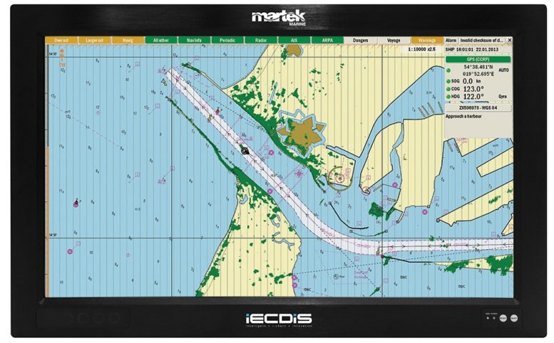
More advanced ECDIS systems, such as Martek Marine’s IECDIS™, is easy to operate and offers multiple chart update options, including email, DVD, and CD-ROM. With the system’s ‘Intelligent iChart Innovation,’ there is no need to manually update charts. The newly patented 4G mobile antennae automatically updates charts every time the vessel enters dock, meaning charts will never be out of date, giving peace of mind that any unnecessary fines or punishments will be avoided.
Non-existent maintenance fees. It’s well known that moving parts equate to on-going maintenance, which can be both costly and disruptive. Some of the latest, expertly designed ECDIS products on the market have no moving parts, and therefore offer no ongoing maintenance fees.
Martek Marine’s range of ECDIS products are designed as a rugged, and military-grade specification for durability. Being robust pieces of equipment, they can cope with harsh maritime conditions. The systems come with a top of the range, glare-resistant screen as a standard feature.
No long-term contracts. Traditional ECDIS products required a huge level of capital investment, topped off with a long-term contract. Reputable companies are starting to offer flexible payment solutions, as well as the option to hire the ECDIS package instead of buying it, meaning no up-front capital investment is required.
Top suppliers are going the extra mile. Take Martek Marine, who is offering a free no-obligation project plan. Martek’s specialists carry out an assessment of a company’s requirements and write a detailed project plan, identifying exactly what type of ECDIS system is needed, what needs to happen and when, to ensure ECDIS is installed and crew are fully trained ahead of the August compliance deadline.
Flexible training, rapid installation and comprehensive after-sales options. Customers want a full-service package when it comes to fulfilling their training, installation and after-sales needs, particularly when technical equipment and technology is involved.
Reputable ECDIS suppliers are offering a range of options to suit different customer requirements. Martek Marine offers flexible service packages and a range of optional extras, including comprehensive compliance reviews that are making things easier for shipping companies. Specialised training options which are delivered in a classroom setting, or on-board a vessel, are helping to maintain optimum productivity by limiting lost work time. System installation is both quick and easy, wherever the vessel is in the world at any time.
Safer navigation through improved hydrographic data. It’s not just the ECDIS suppliers who are busy doing their bit to advance navigation safety. Governments are playing their part too. Have you heard about the latest news surrounding hydrographic data?
Hydrography is the science that measures and describes the physical features of bodies of water and the land close by. The data is used in: nautical charts, sailing directions, lists of lights, tide tables, and other nautical publications with the aim of addressing safe navigation.
All ships are required to carry “adequate and up-to-date charts” under SOLAS Chapter V (Regulation 20) to assist in navigation. In 1983, IMO adopted a resolution referring to the importance of the provision of accurate and up-to-date hydrographic information to safety of navigation, and noted that many areas had not been surveyed to modern standards.
The Resolution was adopted after representation from the IHO, which had informed IMO of the inadequacy of nautical charts of many sea areas, due to dependence on old hydrographic surveys, and noted that in order to develop up-to-date charts for these areas, substantial technical cooperation would be required between developed and developing coastal states on a regional basis.
Contracting governments are therefore coordinating their activities to ensure that hydrographic and nautical information is made available on a world-wide scale as timely, reliably, and unambiguously as possible which will ultimately lead to safer navigation globally.
With the August ECDIS deadline looming, it doesn’t pay to bury your head in the sand. Visit www.martek-marine.com/iecdis-electronic-chart-display-and-information-system-ecdis for more information and contact the team. You will receive a free iPlan ECDIS.