Navigation by definition is the process or activity of accurately ascertaining one’s position and planning, and following a route. Also, navigation is a field of study that focuses on the process of monitoring and controlling the movement of a craft from one place to another.
The past few years have recorded many global maritime incidents, collisions, groundings, and sinkings. The Philippine waters were not spared the catastrophes, although MARINA has made strides in reducing the number in local waters.
Studies have shown bridge communications, distractions, and high reliance on electronic devices is a common denominator for many of the incidents.
The USS Guardian ran aground on Tubbataha Reef about 80 miles southeast of the western island of Palawan. An investigation report stated a faulty electronic chart was a leading cause. There have also been rumors of GPS navigation systems being hacked to disrupt safe navigation of maritime vessels. I do not believe this has ever been confirmed.
There have been many other incidents at sea, on a global scale, attributed to poor navigation and bridge practices such as cell phone use on the bridge, much paperwork and reports to be completed, usage of electronic charts, and GPS –all actually preventing watch standers from looking out the window.
I was on a small cruise ship in Greece a number of years ago and toured the bridge. I noticed one seaman standing front and center at the bridge window never taking his eyes off the horizon over the bow.
The other officers on the bridge were going about performing their duties occasionally going out on the bridge wings to sweep the horizon 360 degrees with binoculars.
One other thing I noticed was a nautical chart on the table with a “dead reckoning” plot of the course we were on and projected out to where we were going.
It also had bearing sightings from known navigational aids for checking our actual position. The electronic chart, auto-pilot, and GPS were also there but these seamen also knew and did things the “old school” way.
I am a firm believer of “old school.” Electronic devices are convenient and for the most part reliable and accurate. But, what if they fail? Electricity and salt water/air don’t mix very well so being prepared is the prudent way to avoid an incident. In my case, I’ve never gotten proficient using a sextant for noon sun sightings and celestial navigation as I’m mostly on coastal waters and not trans-oceanic voyages so I never found the need.
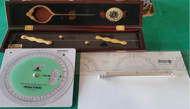
When I took the Greek Captain’s License Exam, I brought my own tools for the navigational portion. I confess it’s been quite some time since I’ve used them but I do get them out occasionally to clean and polish the brass.
I would hope in all maritime schools navigational training will include bearing-taking, dead reckoning course plots, sextant use, and use of actual maritime charts in tandem with the use of electronic navigation aids to produce a well-balanced and proficient navigator. Knowing both where you are and where you’re going is key for a safe voyage.
About the author: Timothy Muelder is a retired Facilities Manager of the U.S. Department of State.