The importance of nautical chart cannot be overemphasized. It is more important to a mariner than a map is to a driver. While the driver can see the road and the obstructions, a mariner cannot directly see the dangers underwater or around him. A chart is important for planning the route but equally important is its updateness to ensure the vessel’s safety. The International Convention for the Safety of Life at Sea (SOLAS) requires that “nautical charts and nautical publications, such as sailing directions, lists of lights, notices to mariners, tide tables and all other nautical publications necessary for the intended voyage, shall be adequate and up to date” (Regulation 27). It is the duty of a navigator that he keeps his chart updated. Otherwise, safety is compromised.
A lot of activities happen in the oceans and seas that can affect the safety of vessels. Even in coastal installations, anything can happen in an instant such as decommissioning of aids to navigation or construction of new piers that might affect safety of life at sea. These activities and changes are published thru Navigational Warnings and Notices to Mariners. These are issued by the Hydrography Branch of the National Mapping and Resource Information Authority (NAMRIA). The Hydrography Branch is the national hydrographic office of the Government of the Philippines. It has the mandate of providing charts covering the Philippine waters and issuing Navigational Warning and Notices to Mariners.
The Notice to Mariners provide Chart Correcting Notices, which provide corrections to 162 NAMRIA issued nautical charts. Chart Correcting Notices are valid until a new chart edition is issued or if a chart is decommissioned or retired. As of 2019, NAMRIA has maintained 4,317 chart correcting notices issued from 1972 to 2019.
Chart Correcting Notices and the Mariner’s Dilemma
A mariner has to keep track of the Notices to Mariners to identify which information may affect his charts and diligently apply them as soon as possible. The whole process can be tedious, time-consuming, and highly prone to human error. If not monitored adequately, corrections may pile up, and eventually lead to erroneous application of corrections. It is not unusual that mariners neglect to correct their chart and will do so only when vessel inspections for compliance with the SOLAS V approach. When this happens, a mariner has to avail all past Notices to Mariners, browse through them one by one, and look for the concerned charts. Britannia Steam Ship Insurance Association Limited (2017) reported that many mariners still do not correct their paper charts despite being familiar with its importance. In some cases, the corrections are identified but not applied. NAMRIA likewise observes private mariners rarely reporting navigationally significant information.
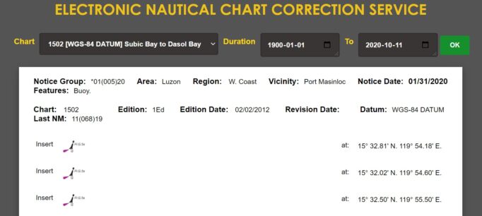
Figure 2. Electronic Nautical Chart Correction
Leveraging technology
Taking advantage of the development in technology, NAMRIA has launched the Online Maritime Safety Information System (OMSIS). The OMSIS is designed to (a) strengthen the mariner’s access to chart-correcting notices, (b) strengthen the collection of navigationally significant information, and (c) strengthen user subscription to Notice to Mariners.
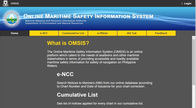
The OMSIS is a free 24/7 service and is accessible at www.namria.gov.ph/omsis (Figure 1). It leverages the use of the internet to help mariners in correcting their NAMRIA nautical charts as they wait for the updated nautical chart at the same time encouraging them to share information observed. Currently, at the initial stage, the OMSIS is a step towards supporting the call for adherence to the S-100 data model of the International Hydrographic Office.
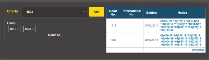
Figure 3. Cumulative List of Notices
The OMSIS has an easy to use interface to search chart correction notices per chart number or date of publication (Figure 2). It contains all the information that can be found in the printed Notices to Mariners. A searchable cumulative list of charts (Figure 3) correcting notices is also available for a summarized listing of notices. Mariners who sign-up to OMSIS may subscribe to specific charts to be automatically notified when a chart correction for the chart is being issued. The website also allows mariners and those working in the maritime industry to report information actually cited through the Electronic Hydrographic Notes, either as a general report thru Form 10 (Figure 4) or as a port information report thru Form 11.
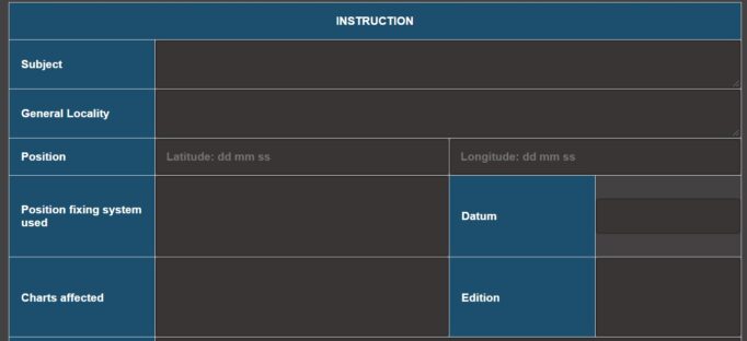
Figure 4. Electronic Hydrographic Note
The OMSIS is being designed to support other modules such as navigational warnings, corrections to Coast Pilot, and corrections to List of Lights. On top of this, NAMRIA will start promulgating the following publications – Annual Summary List of Notices to Mariners and Cumulative List of Notices to Mariners to further ease the burden of the mariner in gathering updated information. The OMSIS is still at its beta stage and any feedback about the system may be emailed to the Maritime Affairs Division, Hydrography Branch, NAMRIA at maritime.affairs@namria.gov.ph.
The OMSIS is a product of the capstone project of Lt Commander Lorena Jasmin D Lerio who graduated with honors from the Master of Development Program of the Development Academy of the Philippines last 25-September-2020.