115th MARITIME FORUM
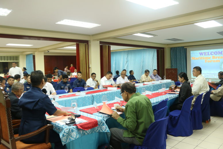
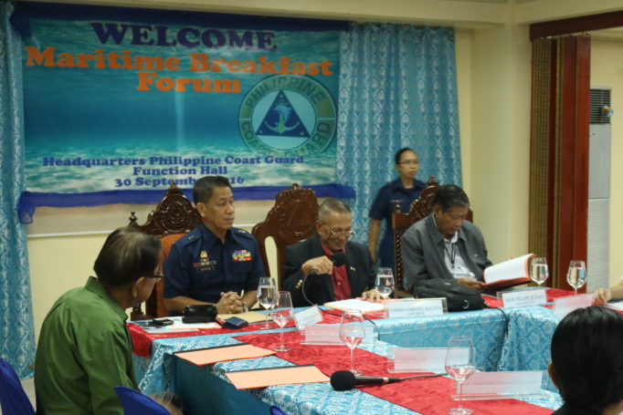
MF 115 was hosted by the PHILIPPINE COAST GUARD (PCG), held at the PCG Building, Port Area, Manila on 30-September-2016.
Commo CARLOS L. AGUSTIN (Ret), FORUM CHAIR thanked the host RADM WILLIAM MELAD, CPCG, and acknowledged HON FELIPE JUDAN, USEC DOTr for Maritime Affairs, as well as the other agency heads present in the Forum.
RADM WILLIAM MELAD welcomed all the participants and expressed the PCG’s continuing support to the FORUM. He cited that the FORUM was born right at the HQ PCG in the early 1990s. After a short coverage of bupdates, the PCG briefer gave a presentation on the following:
- The current PCG mission, organization, functions and activities related to b(Aids to Navigation) system was presented, after which a status of PCG ATON projects was shown. The Chair queried on the current situation vis-à-vis ideal standard ATON requirements as suggested by IALA (International Association of Lighthouse Authorities), and it was shown that the Philippines has quite a low score in that regard. However, there are projects designed to upgrade and bring the Philippines up to par.
- PCG Traffic Separation Schemes highlighted southern Luzon, Visayas and Davao Gulf.
LT RODEL BARRACA PN NCWC Secretariat gave an update on the Sea Vision project.
The Chair said that LTG EDILBERTO P ADAN, former Exec Dir of the VFA Commission, had just left but designated Mr DONG BENEDICTO, President of Benedicto Steel Co., to give the briefing on the PCFR Delegation’s visit to China in relation to the WPS problem. He noted there were 16 in the Delegation consisting of retired Ambassadors, retired senior military and police officers, former government officials and business executives, many of whom are still in active work. A summary of Mr BENEDICTO’s report follows:
- The Philippine Council for Foreign Relations (PCFR) delegation visited Beijing on a people-to-people engagement on 13-16 September, 2016 at the invitation of the Chinese People’s Institute of Foreign Affairs.
- Led by Ambassador JOSE ROMERO, the PCFR is a policy think tank devoted to academic dialogues, policy research, and strategic studies on vital foreign policy issues that include national defense and security. Composed of former Philippine ambassadors and senior diplomats, retired senior officers of the military and the police, as well as business and industry leaders and academicians, the PCFR aims to contribute to promoting national interests, enhancing friendly relations with other countries, and maintaining international peace and security.
- The delegation was welcomed by Ambassador Liu Zhenmin, China’s Vice Foreign Minister, who expressed optimism for a new turning point in the bilateral relations between the two countries, citing the flourishing friendship and many years of cooperation since the opening of diplomatic relations. He welcomed Pres. Rodrigo Duterte’s expressed wish for an improvement of relations and noted the informal talks of former President and Special Envoy Fidel V. Ramos held with Madame Fu Ying and Professor Wu Shicun on 10-11 August 2016 in Hong Kong.
- The delegation met and exchanged views with several think tanks including the China International Institute for Strategic Society, the ASEAN-China Center, the China Institute of International Studies, and the Chinese People’s Institute of Foreign Affairs.
- During the meetings, it was pointed out that South China Sea maritime and territorial disputes were only a small part of the bilateral relations between the two countries. The way to a reinvigoration of bilateral relations can start with discussions of matters of mutual interest, such as marine and environment protection, fisheries, disaster relief and promoting trade, investment, tourism, and cultural and educational exchanges.
- The meetings welcomed the Chairmanship of the Philippines of the ASEAN in 2017, considering the dynamic and robust ASEAN-China dialogue partnership.
- The trip, planned for 13-19 September, to include Beijing, Fuzhou and Xiamen, was cut short to 13-16 due to the super typhoon whose eye passed the last two cities on 17-18 September and were devastated.
Brief updates were given by various agencies concerning developments on the WPS. The PN participant stated that they have received instructions that the area should be demilitarized, to which the Chair asked if the PCG was prepared to take over the Naval Station Pagasa.
This elicited a lot of comments but finally it was suggested that the FORUM should support such action, and COMMO PLARIDEL C GARCIA (RET) suggested that a resolution be passed by the FORUM. There were no objections. The Chair requested Commo GARCIA draft the RESOLUTION, and the body agreed.
MARY ANN PASTRANA, Executive Vice President, Archipelago Philippine Ferries Corporation, gave a brief update on the 41ST Interferry Conference (Manila, 15-19 October, 2016) as the minutes of FORUM 114 covered her earlier update. She invited participants to attend the conference.
116th MARITIME FORUM
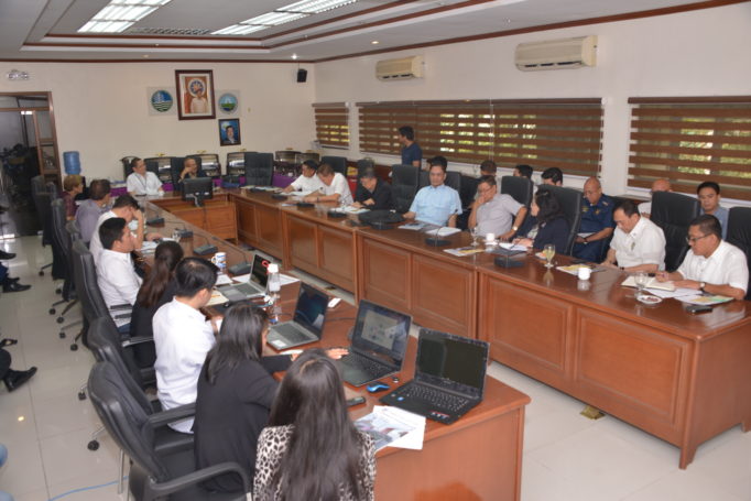
MF 116 was hosted by the NAMRIA and convened at the NAMRIA Board Room, NAMRIA Compound, Ft. Bonifacio, on 28-October-2016.
Commo CARLOS L. AGUSTIN (Ret), FORUM CHAIRMAN, called the forum to order at 8:21AM and thanked NAMRIA for hosting the FORUM. He recalled that NAMRIA hosted the Group in the mid-2000s when DG DIONY A VENTURA was then head of NAMRIA.
JOSE C CABANAYAN DA, NAMRIA apologized that the DG, Dr PETER N TIANGCO, had a crucial engagement. He expressed NAMRIA’s support for the continuing series of the FORUM.
On the matter of approving the draft RESOLUTION on the “Civilianization” of the KCI (Kalayaan Chain of Islands) which was distributed, the Chair asked that before we work on finalizing, we should first seek confirmation from PN or DND whether the information about the SND directive is accurate. No one could affirm that it had actually been issued, so the Chair asked if we could defer it for a future discussion once that matter comes out or is confirmed. It was thus agreed.
The following are the 3 topics and their respective presenters from NAMRIA:
I. Philippine Geoportal by DIR JOHN SANTIAGO F FABIC. DIR FABIC described the NAMRIA National Geographic Data sets which consist of topographic maps and nautical charts. He gave the following core functions of the Agency:
- Geodetic reference system development
- Topographic base mapping
- Hydrography, physical oceanography and nautical charting
- Environment and natural resource mapping
- Maritime zones and boundaries mapping
- Geospatial information management and services
NAMRIA conducts hydrographic and physical oceanographic surveys and produces nautical charts (berthing, harbor, approach, coastal, general sailing and overview charts), predicts tide and plots current tables, provides the coast pilot book and list of lighthouses, sends notices to mariners, and disseminated other nautical publications depicting the country’s maritime jurisdictions.
On maritime zones and boundary mapping, NAMRIA delineates the varied maritime zones of the archipelago including the EEZ and Continental shelves. It spearheaded the successful submission to the United Nations Commission on the Limits of the Continental Shelf, the Philippine extended continental shelf in the Benham Rise Region. It provides technical support to various Government agencies on markers pertaining to maritime boundary delimitation and Law of the Sea issues; and to the local government units on the delineation and delimitation of the 15-kilometer municipal water boundaries.
He also described the key functions of NAMRIA under EO 192 and the Geoportal Project:
Project Phases:
- Phase 1 – jan 2011 to Sep 2012
- Phase 2 – Jan 2013 to Mar 2014
- Phase 3 – within 2016
Objectives:
- To provide a platform for ICT-and GIS-based projects, collaboration, resource optimization and R&D initiatives;
- To promote the One Nation One Map Advocacy of the Government.
Dir FABIC went on to enumerate the Geoportal Data already uploaded by NAMRIA and a few selected agencies that have cooperated with them, and asked all participants to consider informing their colleagues about the project so they can likewise share their own information and data in the Geoportal. He described the process for cooperation (data sharing) to be aptly covered by MOA. He then gave a live interactive demonstration with audience participation.
II. Sea Level Rise and its Implication to the National Territory and Maritime Zones by LCDR CARTER LUMA-ANG PCGS. The Chair noted that the presentation is based on LUMA-ANG’s thesis topic, which is relevant and important for all participants. The Chair noted the paper states CDR LUMA-ANG graduated recently from NDCP. Some highlights of LUMA-ANG’s thesis include:
The data extracted from the models show that the country will lose around 2,946.50 sq.km. and 6,151.52 sq.km. of land areas with a 0.38-meter and 0.82-meter sea level rise, respectively. The land area loss after a 0.82-meter sea level rise is larger than the islands of Cebu and Catanduanes combined. Unlike land area, the total length of coastlines increases as sea level rises. There are laws that use land area, coastlines, and outermost points in their provisions for implementation such as the Local Government Code and The Philippine Fisheries Code. These laws must be amended to prevent any unjust effect to coastal local government units.
More experts seem to favor the ambulatory baselines. Therefore, existing laws and policies of the country should be reviewed and amended if necessary, including the proposed Maritime Zones Bill, to ensure that the alarming impacts of sea level rise in the future will not greatly affect how the Philippine Government manages its own territory and maritime zones.
The Maritime Zones Bill should be revised to state specifically the maritime zone limits by listing the coordinates of the limits. At present, the Bill includes a general statement that the outer limits of the territorial sea and the EEZ shall be 12 NM and 200 NM from the archipelagic baselines, respectively.
The Chair opined that the archipelagic base point may have artificial structures extending upwards, and such structures may still be considered baselines without violating UNCLOS.
III. The Maritime Industry and Crowd-Sourced Bathymetry: Make your Transit Matter by LTJG JAYA ROPERAS. The Chair stated that this presentation has navigational, environmental and charting significance as it is about “Crowd Sourced Bathymetry” (CSB), which is an International Hydrographic Organization (IHO) effort.
With the help of partners, NAMRIA is currently exploring the possibility for every AGENCY and organization with watercraft, including yachts, to become a contributor to the bathymetric data that eventually makes it onto the official maritime charts. In essence, we can have every yacht or vessel enabled to become a true survey vessel and study underwater depth in our rivers, seas, oceans and lakes.
Crowdsourcing is a great solution to the problem of every national hydrographic office: too much water and not enough mapping resources to survey comprehensively, particularly now with a huge EEZ mandate that will take centuries to survey properly, and the use of volunteers with some acoustic and GPS positioning capability (now aboard so many ships and recreational boats) is very appealing.
However, navigation safety depends on quality and accuracy of input data. A cadre of willing but untrained volunteers using uncalibrated equipment of differing quality, with unknown software and algorithms, under varying operating conditions gathering incomplete supporting and metadata is not a substitute for controlled measurements.
Data quality, data processing and liability are important and NAMRIA has to carefully study before accepting third party data for use in nautical charting to help fill in the blanks.
Once collected, survey data is processed using standard procedures to arrive at a final answer and then charted to help mariners make sound navigation decisions. This is a labor-intensive process in which human judgment is intentionally applied. Experience has shown that feeding non-standard sources into this process explodes the labor required far beyond whatever NAMRIA could afford, so it accepts third-party data under certain conditions since accepting random data is costly and inefficient.
There is also the issue of liability as private parties may sue the government for errors in hydrographic surveying and nautical charting.
In spite of these issues, the public’s interest in crowdsourcing hydrographic data is significant to ensure safe and efficient waterways. Thus, NAMRIA is working now on establishing a network of ‘trusted partners’ where it has sufficient control and standards for quality data.
The Chair thanked the presenter, LT JG RAPERAS but opined that a better name for the activity would be “Multi-Sourced Bathymetry, but accepted the explanation that the NOAA and the IHO have adopted the term CSB which has become standard.
Finally, the Chair requested all participants to inform their heads of agencies and companies concerned to study this and cooperate; and also enjoined NAMRIA to continue training and coordinating on this project as it is certainly significant.
Update on the West Philippine Sea (DFA, PN, PCG, BFAR) Update on the West Philippine Sea (DFA, PN, PCG, BFAR, PCFR). The PCG representative confirmed that there is no action on Scarborough Shoal; and that some fishermen from Zambales have gone there and were not molested.
The Chair went on to announce that in the last meeting, the FORUM was informed that in conjunction with the 25h Anniversary of the Maritime League, the presentation of MARITIME AWARDS to selected companies has been slated, and that while a Committee has been designated to formalize the selection, he desired confirmation of the composition as follows:
Chairman: RADM Quirico Evangelista (Ret)
Member: COMMO Mariano Sontillanosa (Ret)
Member: CAPT Robert Patrimonio PCG
The Chair asked if the PCG had no objection on CAPT PATRIMONIO’s designation, and there being no objection raised, the panel composition was thereby confirmed.